Shalom!
Our study commenced in earnest on our second day in Jerusalem. After a preliminary time of teaching at our hotel in the morning, we visited several sites in the city to help us get a firmer understanding of Jerusalem’s geography and development during different periods of Bible history.
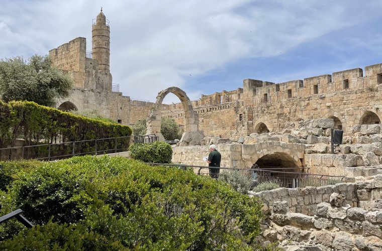
David’s Citadel
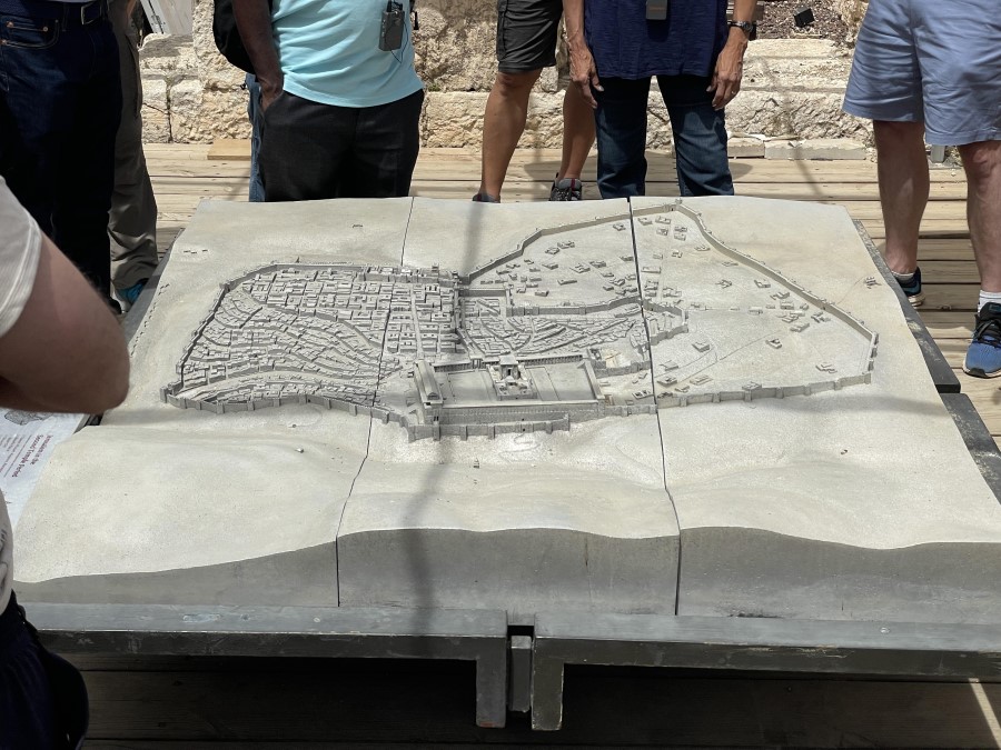
We started the day at David’s Citadel/Tower, one of many sites in Old Jerusalem with a misleading name. The site has nothing to do with King David but was given this name by Roman Christians during the Byzantine period (AD 324-638). The citadel was originally a fortress built on part of the west city wall of Hasmonean Jerusalem (intertestamental period) and then later expanded and incorporated into Herod the Great’s palace complex (first century AD). The version standing today is the sixteenth century battlement created by the Ottoman Turks under Suleiman the Magnificent, hence the high medieval look (see cover photo). Aside from its NT connection, the citadel provides a great view of the city and also features various topographical map sculptures of Jerusalem in different points in history. Also, one room of the citadel, the Kishle, served as a dungeon throughout the centuries and may have been where Pilate had Jesus flogged before Jesus’ crucifixion.
Burnt House
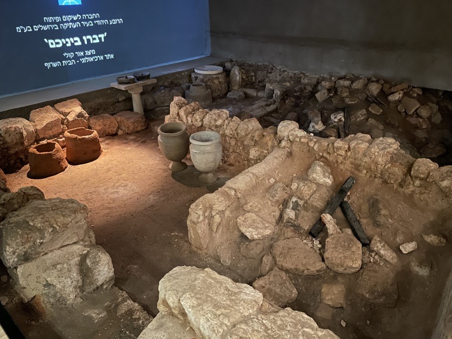
We next visited the Burnt House, the basement of a first century Jewish home likely destroyed in the Roman attack on Jerusalem in AD 70. Besides exhibiting signs of destruction by fire (hence the name), the home has a number of significant artifacts that indicate that it likely belonged to a wealthy, priestly family. Among the finds were stone cups and bowls (which could not be made ritually impure and were expensive to make), an iron spearhead, and a young woman’s severed arm.
Broad Wall
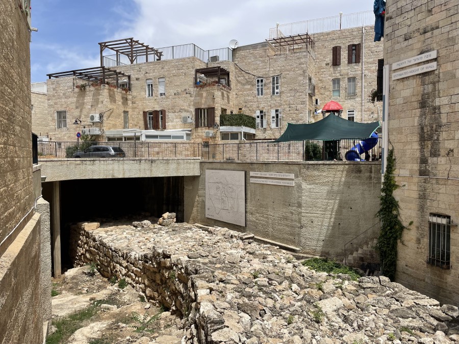
Another site we visited today is the Broad Wall, which is an uncovered portion of the wall constructed by King Hezekiah in preparation for Assyria’s invasion around 712 BC (cf. 2 Kings 18:7, 13). Before Hezekiah, only the eastern hill of Jerusalem, the hill containing the City of David and Solomon’s Temple, was fortified. Hezekiah, however, enclosed a large portion of Jerusalem’s western hill (today called “Mount Zion” due to an erroneous attribution by medieval crusaders) within city walls. This new wall addition was formidable since it stood above the steep Hinnom Valley, which bounded ancient Jerusalem on the south and west. However, the northern section of the new wall did not have as deep a valley below, which meant the northern wall was more vulnerable to attack. To counter this vulnerability, Hezekiah made the northern wall extra thick: while the other sections of wall were about three meters thick, the northern wall was eight meters thick. The uncovered section of this “broad wall” no longer has its full height, but you can still see its mighty thickness. Furthermore, you can even see (though not in the above picture) the foundations of homes that were destroyed to make way for the wall’s construction. Dr. G noted our viewing of the Broad Wall in connection with Isa 22:8-11; making wise defensive preparations is good, but one must ultimately depend on God. Hezekiah lived by that truth, but the people of Judah often did not.
Upper Room

There are several sites in Jerusalem that might have served as the site of the last supper, but the one Dr. G took us to as the most probable location is known as the Cenacle or “Upper Room” in the Church of the Apostles on Mount Zion. The original first century building was, of course, lost in Jerusalem’s AD 70 destruction; the building standing on the spot today is a medieval construction. However, this later building was constructed upon several layers of previous constructions. One of the lower layers dates to the first or second century AD and appears to have served as a synagogue as the building had a discernable niche for storing the Scriptures. Intriguingly, this niche points exactly in the direction of the Church of the Holy Sepulcher, that is, the site of Jesus’ crucifixion, burial, and resurrection. The first-second century building, then, likely served as an early Jewish-Christian church (before church buildings were a thing), just as several early church writers also attest. If so, the synagogue-church may have been built on the same spot as Jesus’ last supper in commemoration.
Steps to Gethsemane
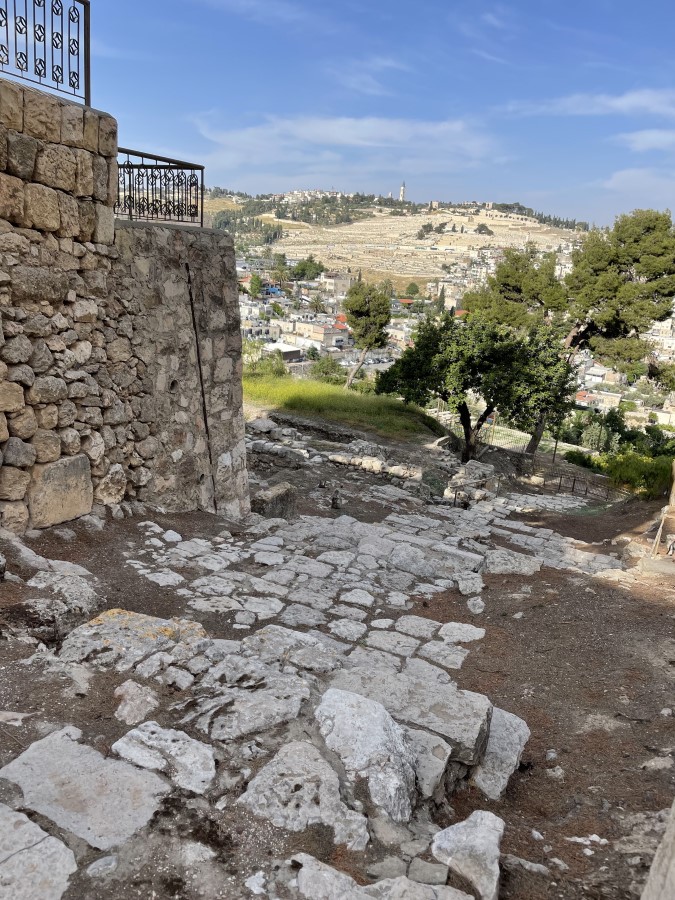
Our final stop for the day was a set of stone steps outside the Church of St. Peter in Gallicantu. There is some debate as to whether the steps are from the first century or the sixth century AD. If they are from the first century, then these would be the very same steps that Jesus took with his disciples to Gethsemane on the night of his betrayal; Jesus would have traveled from the last supper in the Upper Room down the steps to a southern gate of Jerusalem to cross the Kidron valley and arrive at the base of the Mount of Olives (cf. Mt 26:30).